Ancient Drawings of the Holy City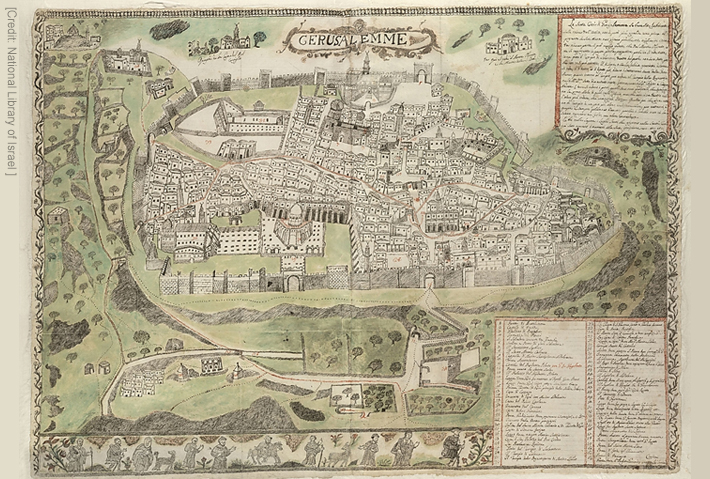
Throughout its long history, the Holy City has always captured the hearts of scholars, researchers, and Christian pilgrims…Throughout its long history, the Holy City has always captured the hearts of scholars, researchers, and Christian pilgrims. While they may not have known much about Jerusalem’s geography, that didn’t stop them from making maps. One curator, Dr. Milka Levy-Rubin, a staff member at the National Library of Israel, put together a collection of the city’s most ancient maps, showing us the many ways the Holy City has been drawn.
Throughout its long history, the Holy City has always captured the hearts of scholars, researchers, and Christian pilgrims… |
|
|
Success! You should receive an email confirming that you have been signed up to receive emails from The Fellowship shortly.
Newsletter Signup
Success!
You should receive an email confirming that you have been signed up to receive emails from The Fellowship shortly.
Login
Error
Account Created
Success!
Your new username has been emailed to you.
It may take a few minutes to receive this email.
You have been logged in.

